 |  |  |
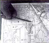
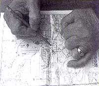
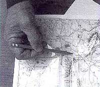
| Step 1 | Step 2 | Step 3 |
The overlay, which is included with the Ghost Town map series, has been reproduced from a modern map. The purpose is to show the changes in the state over a period of 100 years. Place names may appear on the older map which are absent on the current map because some of these locations may have been early stage stations, mining camps, ranches or early town sites later abandoned. The different locations noted in boundaries, landmarks and place names are evident. Being aware of the difficulties encountered by the early surveyors, due to lack of knowledge and primitive equipment, the errors are most certainly understood.
As shown in the photos:
- Locate a site on the map.
- Place the overlay on the map.
- Line up the overlay boundary marks of the page onto the corresponding boundary marks on the base map.
- Place a pointer on the site – insert a white card between the map and overlay and the site will be located on the modern road system.
Accuracy and scale of the maps are not guaranteed, however, one may locate a general area of interest with this technique.
